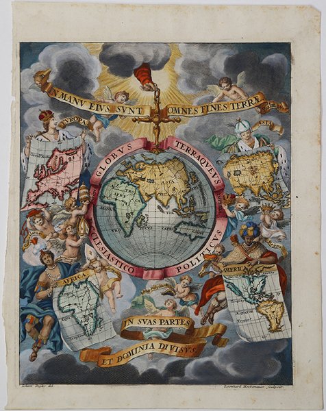
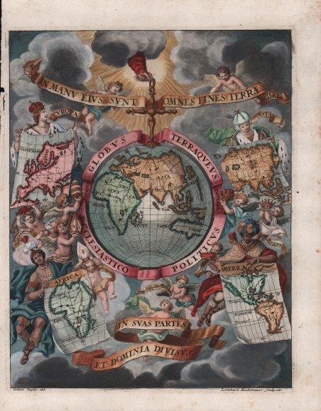
Globus Terraqueus Ecclesiastico Politicus In Suas Partes et Dominia Divisus.
Globus Terraqueus Ecclesiastico Politicus In Suas Partes et Dominia Divisus. | Grabados | SCHERER Henrick

Globus Terraqueus Ecclesiastico Politicus In Suas Partes et Dominia Divisus.
Globus Terraqueus Ecclesiastico Politicus In Suas Partes et Dominia Divisus. | Grabados | SCHERER Henrick
Formas de Pago
- PayPal
- Tarjeta de crédito
- Transferencia Bancaria
- Pubblica amministrazione
- Carta del Docente
Detalles
- Año de publicación
- 1703
- Lugar de impresión
- Monaco
- Formato
- 190 X 237
- Grabadores
- SCHERER Henrick
- Materia
- Frontespizi e Allegorie
Descripción
La stampa decorativa mostra la mano di Dio che tiene sospeso il mondo attraverso una croce fissata sul Polo Nord. I cieli circostanti sono popolati di cherubini, alcuni dei quali reggono corone e capricapi di papi, cardinali e vescovi. Rappresentazioni allegoriche dei continenti d'Europa, Asia, Africa e America. Nel continente americano, la California è rappresentata come un'isola. Decorativa carta geografica pubblicata nell'opera di Heinrich Scherer ' Atlas Novus exhibens orbem terraguem per naturae opera, historiae navae acveterus monumenta, artistique geographicae leges et praecepta ' edita in 8 parti, stampate tra il 1702 e il 1710 a Monaco di Baviera. Heinrich Scherer, professore di matematica a Monaco di Baviera, era un gesuita devoto la cui opera sottolineava la gerarchia cattolica e la diffusione delle missioni gesuite in tutto il mondo. Il suo Atlas Novus contiene mappe di tutte le altre parti che mostravano la diffusione del cattolicesimo e delle missioni gesuite. Incisione in rame, finemente colorata a mano, in ottimo stato di conservazione. The page features the hand of God suspending the world from a cross attached at the Pole. The surrounding heavens are filled with winsome cherubs, some of whom hold crowns and the hats of popes, cardinals and bishops, with allegorical representations of the continents of Europe, Asia, Africa and America. All of the continental figures hold a map, with the one representing the Americas featuring California as an island. Heinrich Scherer, professor of mathematics at Munich, was a devout Jesuit whose work emphasized the Catholic hierarchy and the spread of Jesuit missions throughout the world. The important, large river systems are exceptionally well illustrated. Many placenames are included in the interior as well as on the coasts. Heinrich Scherer was a devout Jesuit, and professor of mathematics at Munich. Map taken from the Atlas Novus exhibens orbem terraguem per naturae opera, historiae navae acveterus monumenta, artistique geographicae leges et praecepta, published in 8 parts, printed between 1702 and 1710 in Munich. His 'Atlas Novus' contained maps of all other parts which showed the spread of Catholicism and Jesuit missions. Copperplate with later hand colour, very good condition. Cfr.
