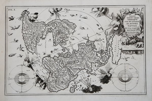
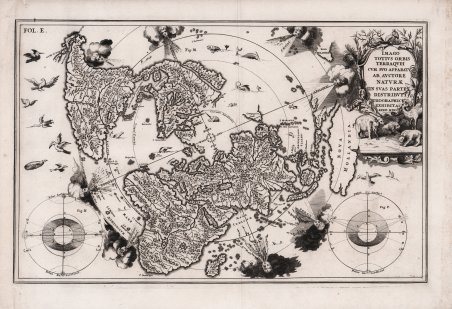
Imago Totius Orbis Terraquei cum suo apparatu Ab Auctore Naturae in Suas Partes Distributi Geographice Exhibita. Anno MDCC
Imago Totius Orbis Terraquei cum suo apparatu Ab Auctore Naturae in Suas Partes Distributi Geographice Exhibita. Anno MDCC | Grabados | SCHERER Henrick

Imago Totius Orbis Terraquei cum suo apparatu Ab Auctore Naturae in Suas Partes Distributi Geographice Exhibita. Anno MDCC
Imago Totius Orbis Terraquei cum suo apparatu Ab Auctore Naturae in Suas Partes Distributi Geographice Exhibita. Anno MDCC | Grabados | SCHERER Henrick
Formas de Pago
- PayPal
- Tarjeta de crédito
- Transferencia Bancaria
- Pubblica amministrazione
- Carta del Docente
Detalles
- Año de publicación
- 1699
- Lugar de impresión
- Monaco
- Formato
- 362 X 230
- Grabadores
- SCHERER Henrick
- Descripción
- Shirley #627.
Descripción
Decorativa carta geografica pubblicata nell'opera di Heinrich Scherer Atlas Novus exhibens orbem terraguem per naturae opera, historiae navae acveterus monumenta, artistique geographicae leges et praecepta edita in 8 parti, stampate tra il 1702 e il 1710 a Monaco di Baviera. Questa insolita proiezione polare rappresenta il mondo intero, eccetto il Polo Sud. La California è mostrata come un'isola ed è rappresentata la suggestione del "Passaggio a Nord-Ovest" attraverso la Baia di Hudson. Raffigurata anche una parte distorta dell'Australia, nota come Nova Hollandia. La mappa ha deliziose raffigurazioni di uccelli e teste di vento nei cieli, così come pesci e mostri che nuotano nei mari. Il bellissimo cartiglio è pieno di animali e due piccoli diagrammi astronomici fiancheggiano la mappa. Heinrich Scherer, professore di matematica a Monaco di Baviera, era un gesuita devoto la cui opera sottolineava la gerarchia cattolica e la diffusione delle missioni gesuite in tutto il mondo. Il suo Atlas Novus contiene mappe di tutte le altre parti che mostravano la diffusione del cattolicesimo e delle missioni gesuite. Incisione in rame, in ottimo stato di conservazione. This unusual polar projection depicts the entire world except the South Pole. California is shown as an island and there is a suggestion of a Northwest Passage via Hudson Bay. There is a distorted portion of Australia noted as Nova Hollandia. The map has delightful depictions of birds and wind heads in the heavens as well as fish and monsters swimming the seas. The beautiful cartouche is filled with animals and two small astronomical diagrams flank the map. Heinrich Scherer, professor of mathematics at Munich, was a devout Jesuit whose work emphasized the Catholic hierarchy and the spread of Jesuit missions throughout the world.The important, large river systems are exceptionally well illustrated. Many placenames are included in the interior as well as on the coasts. Heinrich Scherer was a devout Jesuit, and professor of mathematics at Munich. Map taken from the ' Atlas Novus exhibens orbem terraguem per naturae opera, historiae navae acveterus monumenta, artistique geographicae leges et praecepta, ' published in 8 parts, printed between 1702 and 1710 in Munich. His 'Atlas Novus' contained maps of all other parts which showed the spread of Catholicism and Jesuit missions. Cfr. Shirley #627.
