Italy with the addition of the Southern Parts of Germany as far as Pettau in Stiria; Murlakia, Dalmatia The adjacent countries, and all the Iliric Islands.
Italy with the addition of the Southern Parts of Germany as far as Pettau in Stiria; Murlakia, Dalmatia The adjacent countries, and all the Iliric Islands. | Grabados | DE LA ROCHETTE L.S. - FADEN WILLIAM
Grabados
DE LA ROCHETTE L.S. - FADEN WILLIAM
1800
1000,00 €
(Verona,
Italia)
Formas de Pago
- PayPal
- Tarjeta de crédito
- Transferencia Bancaria
- Pubblica amministrazione
- Carta del Docente
Detalles
- Año de publicación
- 1800
- Lugar de impresión
- Londra
- Editor
- William Faden
- Grabadores
- DE LA ROCHETTE L.S. - FADEN WILLIAM
- Materia
- Italia
Descripción
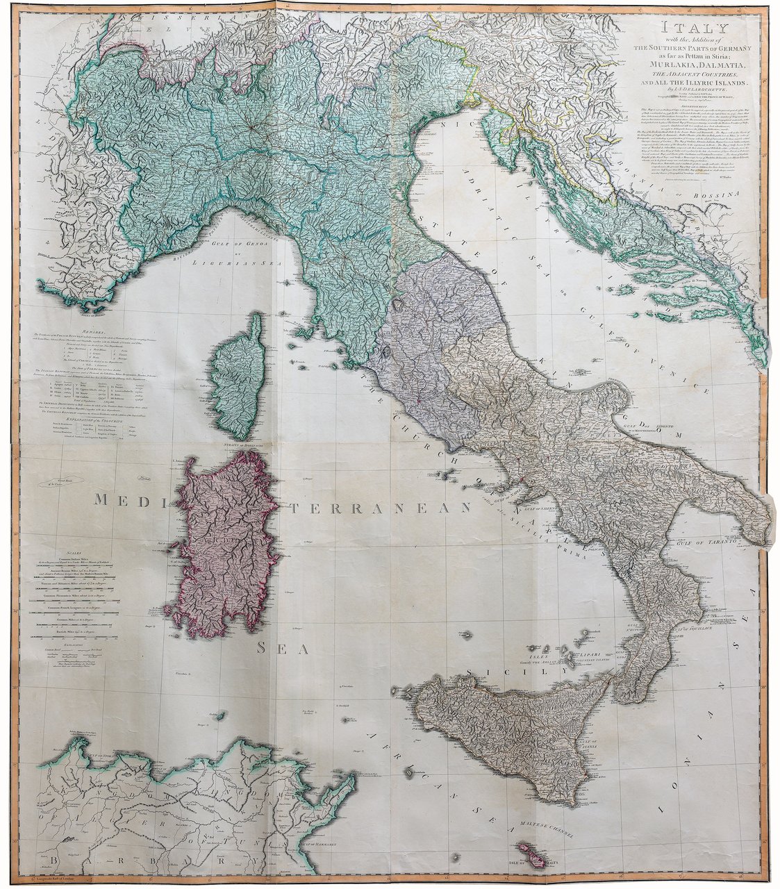
Incisione in rame, dipinta a mano, cm 125x108. Magnifica carta geografica di tutta l'Italia inquadrata da bordura, incisa finemente in rame su 4 fogli a colori coevi a pieno campo, stampata su carta forte. La mappa include oltre all'Italia, la Slovenia e la Penisola Balcanica. Sono segnate strade e itinerari postali. Scala delle miglia in basso a sinistra. Tratta da General Atlas di Faden. Ottimo esemplare. <BR>
