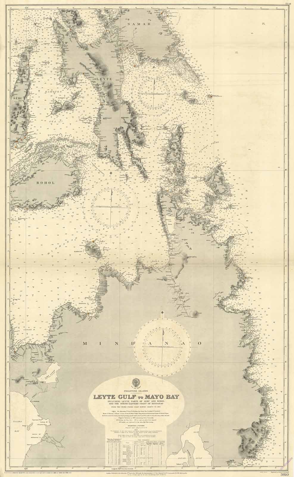
Leyte Gulf to Mayo Bay including Leyte parts of Sebu and Bohol and the North-Eastern coast of Mindanao
Grabados
Admiralty Charts
1924-1931
Leyte Gulf to Mayo Bay including Leyte parts of Sebu and Bohol and the North-Eastern coast of Mindanao
Grabados
Admiralty Charts
1924-1931
300,00 €
(Gavirate,
Italia)
Formas de Pago
- PayPal
- Tarjeta de crédito
- Transferencia Bancaria
- Pubblica amministrazione
- Carta del Docente
Detalles
- Año de publicación
- 1924-1931
- Formato
- mm 1085x700 (il foglio)
- Edición
- 1924 [1931]
- Materia
- Philippine - Filippine - Leyte - Sebu
- Diseñadores
- Admiralty Charts
Descripción
Carta nautica delle Filippine raffigurante le isole di Samar, Leyte, Sebu, Bohol, Dinagat, Siargao, Kamiguin e Mindanao. La carta deriva dalle carte dei rilievi costieri degli Stati Uniti del 1922. Pieghe editoriali. Il dominio statunitense ebbe inizio nel 1898 quando, in seguito alla vittoria nella Guerra ispano-americana, la Spagna si vide costretta a cedere Filippine, Cuba, Porto Rico e Guam agli Stati Uniti. During this period, the Philippines was under the colonial rule of the United States of America. American rule began in 1898 when, following its victory in the Spanish-American War, Spain was forced to cede the Philippines, Cuba, Puerto Rico, and Guam to the United States.