Nouvelle Carte Des Decouvertes Faites par Des Vaisseaux Russiens Aux Cotes Inconnues De L'Amerique Septentrionale Avec Les P
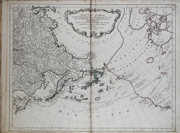
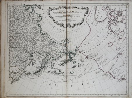
Nouvelle Carte Des Decouvertes Faites par Des Vaisseaux Russiens Aux Cotes Inconnues De L'Amerique Septentrionale Avec Les P
Formas de Pago
- PayPal
- Tarjeta de crédito
- Transferencia Bancaria
- Pubblica amministrazione
- Carta del Docente
Detalles
- Año de publicación
- 1784
- Lugar de impresión
- Venezia
- Formato
- 670 X 510
- Grabadores
- REMONDINI Giuseppe
- Materia
- Terre Artiche
- Descripción
- Hayes p. 29-32, Kershaw, 1146, Verner & Stuart-Stubbs, 38, p. 272-275, Wagner, 633.
Descripción
La mappa è la versione di Remondini della precedente carta di Gerhard Muller del 1754 che mostra le scoperte dei capitani Bering e Tschiikow.Muller pubblicò la sua mappa in risposta alla carta di J. Delisle, disegnata da Philippe Buache, che mostrava per la prima volta le scoperte russe e un' elaborata, quanto speculativa rappresentazione del viaggio immaginario dell'ammiraglio De Fonte attraverso il passaggio a Nord-Ovest.La mapa fu aggiornata diverse volte; significativa la versione del 1773, dopo la spedizione di Ivan Synd, in cui la penisola è stata ridotta in favore di un più esteso gruppo di isole.Incisione su rame, piega du carta verticale al centro, per il resto in ottimo stato di conservazione. Remondini's version of Gerhard Muller's landmark map of 1754 showing the discoveries of Captains Bering and Tschirikow.Muller originally published his map in response to Joseph Delisle and Philippe Buache's map that showed previously unknown Russian discoveries and an elaborate (and entirely speculative) depiction of the imaginary voyage of Admiral De Fonte through a Northwest Passage. The map was updated several times, most significantly in 1773 after the expedition of Ivan Synd in which the elongated peninsula was shortened in favor of a large group of islands. Interestingly the speculative Northwest Passage is still shown connecting to Hudson Bay via a mythical River of the West. Dated on the plate 1784.The map was published in the Remondini's atlas, who bought in 1784 Santini's plates from his "Atlas Universel dresse sur les meuilleures cartes modernes" of 1776. This map however was only included in Remondini's atlas of 1784. Copperplate with original outline colour, light folds in the middle, otherwise good condition. Cfr. Hayes p. 29-32, Kershaw, 1146, Verner & Stuart-Stubbs, 38, p. 272-275, Wagner, 633.