Detalles
Lugar de impresión
Amsterdam
Grabadores
BLAEU Willem Janszoon
Descripción
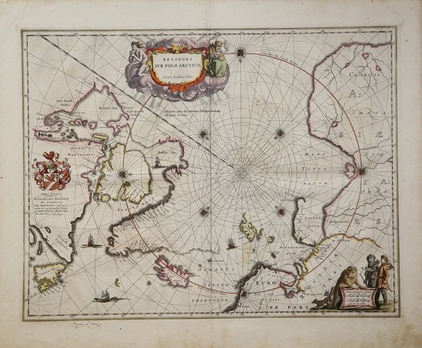
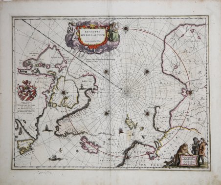
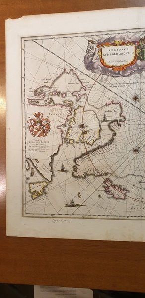
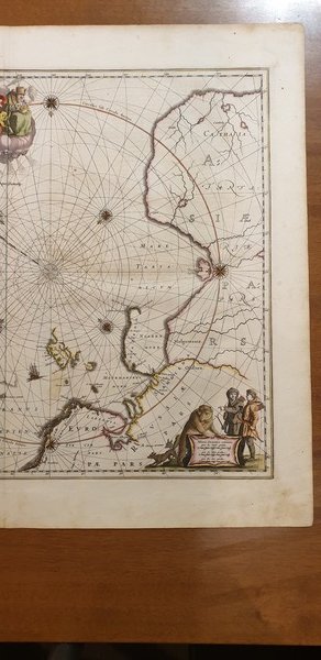
Magnifico esemplare della importante carta delle regioni settentrionali di Willelm Blaeu.La carta raffigura le recenti scoperte riportate dalle esplorazioni al Polo Nord, tra la fine del XVI e l'inizio del XVII secolo. La Groenlandia presenta molti toponimi costieri e sono rappresentati sia lo Spitsberg che la Nova Zemla. Esemplare tratto da edizione tedesca dell'Atlas Major di Johannes Blaeu. Willem Janszoon Blaeu, avviò nel 1599 la sua attività di costruttore di globi e strumenti astronomici ad Amsterdam. Nel 1630, dopo aver comprato alcune lastre dell’atlante del Mercator da Jodocus Hondius II, fu in grado di pubblicare un volume di 60 mappe con il titolo di ' Atlantis Appendix. Cinque anni dopo, pubblicò i primi due volumi del suo atlante ' Atlas Novus ' o ' Theatrum Orbis Terrarum, ' in sei libri. Dopo la sua morte, Joan (Johannes) continuò l’opera paterna, completando l’intera serie di sei volume dell’Atlas Novus ' intorno al 1655. Fu inoltre autore di un ' Atlas Maior sive Cosmographia Blaviana, in 12 volumi pubblicati nel 1662 -72. Incisione in rame, bellissima coloritura coeva, in perfetto stato di conservazione. A nice example of Blaeu's signature map of the North Polar Regions, with several wonderful cartouches and decorative coat of arms. Wonderful detail, both real and imaginary, throughout the map. The discoveries of the late 16th and early 17th Centuries are plainly in evidence throughout Hudson's Baffin's and Buttons Bay, along with Davis Straits. Greenland has many bays named. Spitsberg and Nova Zemla are shown, but I not in a complete fashion. 8 compass roses and 4 sailing ships. The North Pole is the center of this map which shows the coastlines of the countries in the Artic Circle.The decorative title cartouche is in the upper part of the map with cherubs and personifications of the wind and winter. In the lower right is the map legend surrounded by two Eskimos, a polar bear and a fox. ' Willem Janszoon Blaeu, started in 1599 his business as a builder of globes and astronomical instruments in Amsterdam. In 1630, after buying some plates of the Mercator atlas from Jodocus Hondius II, he was able to publish a volume of 60 maps under the title ' Atlantis Appendix. Five years later, he published the first two volumes of his atlas ' Atlas Novus ' or ' Theatrum Orbis Terrarum, in six books. After his death, Joan (Johannes) continued his father's work, completing the entire six-volume ' Atlas Novus ' series around 1655. He was also the author of an ' Atlas Maior sive Cosmographia Blaviana, in 12 volumes published in 1662 -72. A nice old color example of this highly sought after map, taken from a German edition of “Atlas Major” by Johannes Blaeu. Cfr.

 Descubre cómo utilizar
 Descubre cómo utilizar