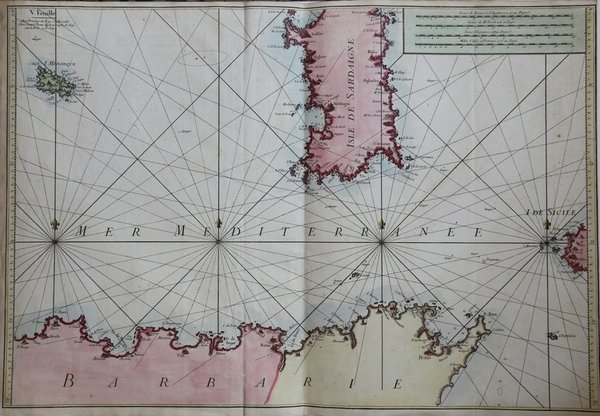
V. Feuille
V. Feuille | Grabados | ROUX Joseph

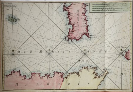
V. Feuille
V. Feuille | Grabados | ROUX Joseph
Formas de Pago
- PayPal
- Tarjeta de crédito
- Transferencia Bancaria
- Pubblica amministrazione
- Carta del Docente
Detalles
- Año de publicación
- 1764
- Lugar de impresión
- Marsiglia
- Formato
- 820 X 585
- Grabadores
- ROUX Joseph
- Descripción
- L. Piloni, "Carte geografiche della Sardegna", tav. LXXIII
Descripción
Carta nautica del Mediterraneo centrale. La carta è incentrata sulla Sardegna ma comprende anche l’isola di Minorca, l’estrema punta occidentale della Sicilia, e le coste africane ad ovest di Capo Bon, con la Tunisia e l’Algeria. La carta costituisce il quinto dei dodici fogli che compongono il portolano del Mediterraneo del Roux, intitolato "Carte de la Mer Mediterranee en douze feuilles". Incisione in rame, stampata su carta azzurra, lfinemente colorata a mano, in ottimo stato di conservazione. Sea chart of the central Mediterranean sea. The chart is about Sardinia, but it also depicts Minorca, the Western part od Sicily and the African coasts from Cape Bon, with Tunisia and Algeria. The chart is the fifth out of twelve sheets which are part of the Mediterranean pilot book of Roux, entitled "Carte de la Mer Mediterranee en douze feuilles" Copper engraving, printed on light-blue paper, nice hand colouring, in excellent condition. Cfr. L. Piloni, "Carte geografiche della Sardegna", tav. LXXIII
