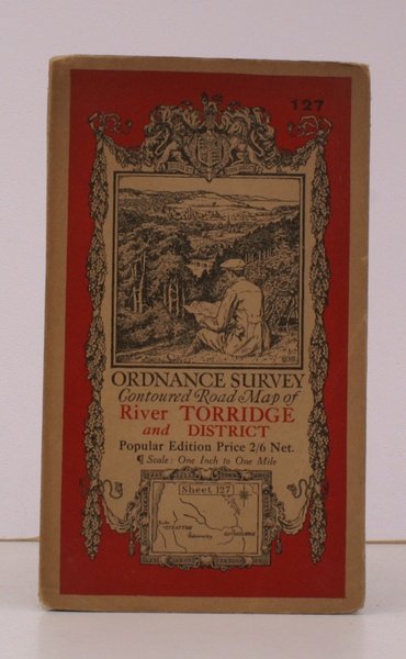
Ordnance Survey Contoured Road Map of River Torridge and District. Sheet 127. Scale: One Inch to to One Mile. BRIGHT, CLEAN COPY
Ordnance Survey Contoured Road Map of River Torridge and District. Sheet 127. Scale: One Inch to to One Mile. BRIGHT, CLEAN COPY | Rare and modern books | Ordnance Survey
Rare and modern books
Ordnance Survey
Ordnance Survey, Southampton,
1931
20.70 €
(Devon,
United Kingdom)
Payment methods
- PayPal
- Credit card
- Bank transfer
- Pubblica amministrazione
- Carta del Docente
Details
- Year of publication
- 1931
- Author
- Ordnance Survey
- Publishers
- Ordnance Survey, Southampton
- Keyword
- topography, cartography, maps, ordnance survey, torridge, stratton, hatherleigh, ellis martin
- Languages
- English
Description
Folding coloured map on cloth measuring 22 x 30 ins (approx. 56 x 76 cms) folding in 21 panels to 7.0 x 4.0 ins (approx. 17.7 x 10.1 cms); original pictorial card wrappers, a very good, bright, clean copy. The famous Popular Edition One Inch series with striking 'cyclist' artwork by Ellis Martin was issued in 1919. This is the 1931 revision. . The covers are black with red sheet name and location map. Browne, 11.1.a
