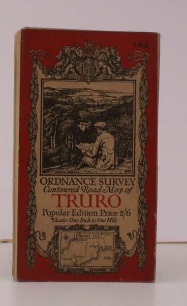
Ordnance Survey Contoured Road Map of Truro and St. Austell. Sheet 143. Popular Edition. Scale: One Inch to to One Mile. BRIGHT, CLEAN COPY
Ordnance Survey Contoured Road Map of Truro and St. Austell. Sheet 143. Popular Edition. Scale: One Inch to to One Mile. BRIGHT, CLEAN COPY | Rare and modern books | Ordnance Survey
Rare and modern books
Ordnance Survey
Ordnance Survey, Southampton,
1927
18.40 €
(Devon,
United Kingdom)
Payment methods
- PayPal
- Credit card
- Bank transfer
- Pubblica amministrazione
- Carta del Docente
Details
- Year of publication
- 1927
- Author
- Ordnance Survey
- Publishers
- Ordnance Survey, Southampton
- Keyword
- topography, cartography, maps, ordnance survey, truro, st. austell, ellis martin
- Languages
- English
Description
Folding coloured map on cloth measuring 26 x 35 ins (approx. 66.0 x 88.0 cms) folding in 36 panels to 7.0 x 4.0 ins (approx. 17.7 x 10.1 cms); original pictorial card wrappers, one or two small stains on map surface else a bright, clean copy. The famous Popular Edition One Inch series with striking 'cyclist' artwork by Ellis Martin was first issued in 1918. This is the 1927 revision. The covers are black with red sheet name and location map. Browne, 11.1.a
