Rand, McNally & Co.'s 1901 Map of the "Western Portion of Oklahoma"/ Indian Territory and Oklahoma
Rand, McNally & Co.'s 1901 Map of the "Western Portion of Oklahoma"/ Indian Territory and Oklahoma | Rare and modern books | Author Not Stated
Rare and modern books
Author Not Stated
Rand McNally,
1902
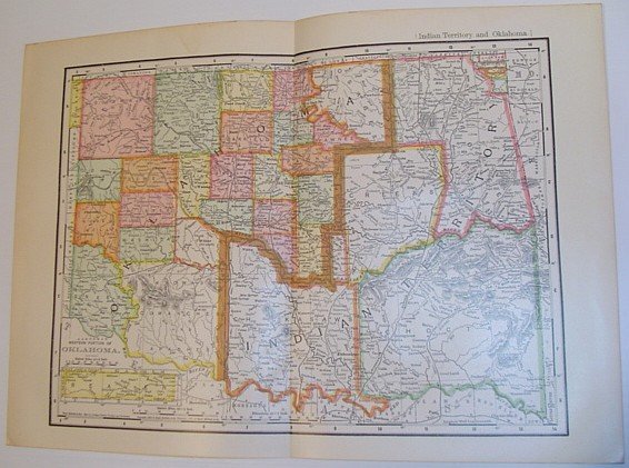
495.00 €
(Ladysmith,
Canada)
Payment methods
- PayPal
- Credit card
- Bank transfer
- Pubblica amministrazione
- Carta del Docente
Details
- Year of publication
- 1902
- Place of printing
- USA
- Author
- Author Not Stated
- Publishers
- Rand McNally
- Size
- Folio - over 12" - 15" tall
- Edition
- Reprint
- Keyword
- Indian Territory Oklahoma State History Boundaries Counties Maps
- Binding description
- Map
- State of preservation
- Very Good
- Languages
- English
- First edition
- False
Description
Outside dimensions 14.5" x 10.5". Circa 1902. Centerfold. Light wear. Please see our photo for details. Book
