Cape Van Den Bosch to Patipi Bay
Cape Van Den Bosch to Patipi Bay | Prints | Admiralty Charts
Prints
Admiralty Charts
Cape Van Den Bosch to Patipi Bay
Cape Van Den Bosch to Patipi Bay | Prints | Admiralty Charts
Prints
Admiralty Charts
100.00 €
(Gavirate,
Italy)
Payment methods
- PayPal
- Credit card
- Bank transfer
- Pubblica amministrazione
- Carta del Docente
Details
- Size
- mm 982x641
- Edition
- '900
- Designers
- Admiralty Charts
Description
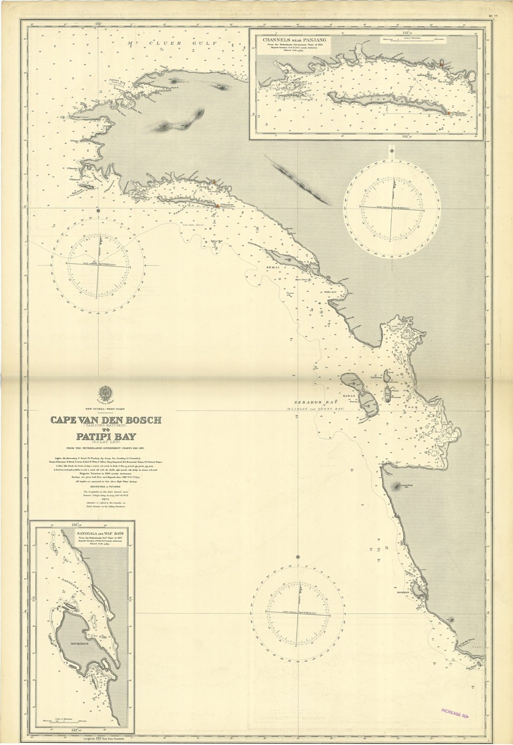
Cape Van Den Bosch to Patipi Bay from the Netherlands Government charts 1916-1919.In the upper right corner of the chart insert of Channels near Panjang From the Netherlands Government Chart of 1919. In the lower left corner insert of Sanggala and Wap Bays from the Netherlands Gov.t Chart of 1917. London Published at the Admiralty, 31st March 1920, under the Superintendence of Rear Admiral Fred. C. Learmonth, Hydrographer.Small corrections: 1929. Cape Van Den Bosch to Patipi Bay
Anno di pubblicazione: '900
