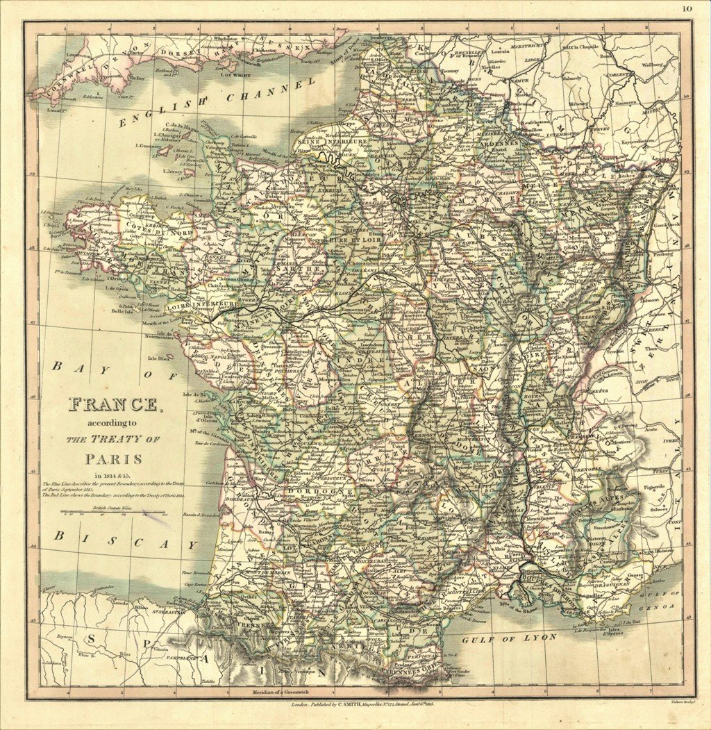
France according to the treaty of Paris in 1814 & 15
France according to the treaty of Paris in 1814 & 15 | Prints | Smith Charles edit., Smith Charles edit.
Prints
Smith Charles edit., Smith Charles edit.
1820
France according to the treaty of Paris in 1814 & 15
France according to the treaty of Paris in 1814 & 15 | Prints | Smith Charles edit., Smith Charles edit.
Prints
Smith Charles edit., Smith Charles edit.
1820
40.00 €
(Gavirate,
Italy)
Payment methods
- PayPal
- Credit card
- Bank transfer
- Pubblica amministrazione
- Carta del Docente
Details
- Year of publication
- 1820
- Size
- mm 352x350
- Edition
- 1820
- Engravers
- Smith Charles edit.
- Keyword
- Francia
- Designers
- Smith Charles edit.
- Languages
- Italian
Description
Carta geografica, in coloritura coeva, riguardante la Francia dopo gli accordi di Parigi del 1814 e 15. Inserita nell'opera "Smith's New General Atlas Containing Distinct Maps Of all the Principal Empires, Kingdoms, & States Throughout the World arranged according to the General Treaty signed in Congress at Vienna June 1815 - London, Printed for C. Smith, Mapseller extraordinary, To His Majesty. N° 172 Strand with additions 1822 to 1824". Edizione non menzionata dal Phillips
