Islands and Anchorages in Cook Islands
Islands and Anchorages in Cook Islands | Prints | Admiralty Charts, Admiralty Charts
Islands and Anchorages in Cook Islands
Islands and Anchorages in Cook Islands | Prints | Admiralty Charts, Admiralty Charts
Payment methods
- PayPal
- Credit card
- Bank transfer
- Pubblica amministrazione
- Carta del Docente
Details
- Size
- mm 960x661
- Edition
- '900
- Engravers
- Admiralty Charts
- Keyword
- Cook Islands - Pacific Ocean
- Designers
- Admiralty Charts
- Languages
- Italian
Description
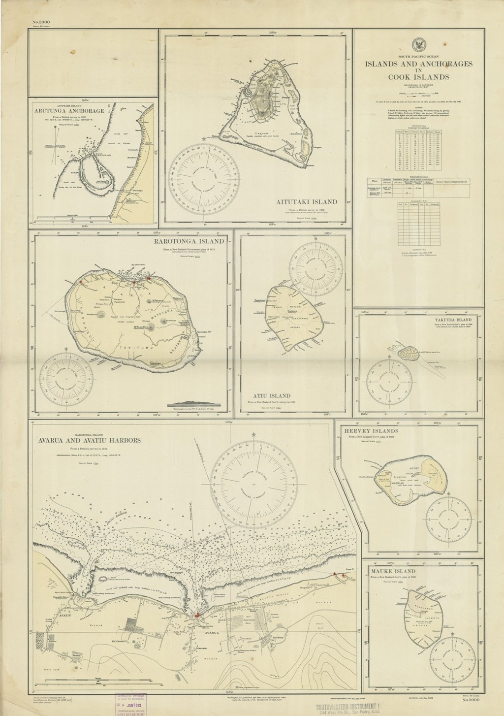
Islands and Anchorages in Cook Islands In the upper left side of the chart insert of Arutunga Anchorage From a British Survey in 1892 and Rarotonga Island From a New Zealand Government plan of 1913 (with additions from a British survey in 1922). In the middle of the chart insert of Aitutaki Island From a British survey in 1892 (with additions from a New Zealand Gov.plan of 1906) and Atu Island From a New Zealand Gov. survey in 1919. In the right part of the chart insert of Hervey Islands From a New Zealand Gov. plan of 1906 and Mauke Island From a New Zealand Gov. plan of 1906. In the lower part of the chart insert of Avarua and Avatiu Harbors From a British survey in 1922. Washington D.C., published Apr. 1902, at the Hydrographic Office, under the authority of the Secretary of the Navy. Small corrections: Printed Mar. 1928. Folded editorialyy. Autore: Admiralty Charts. Luogo: Cook Islands - Pacific Ocean. Anno: '900. Tecnica: incisione. Dimensioni: 960x661 mm
Anno di pubblicazione: '900
