Luzon Island
Luzon Island | Prints | Admiralty Charts
Prints
Admiralty Charts
1925-1931
Luzon Island
Luzon Island | Prints | Admiralty Charts
Prints
Admiralty Charts
1925-1931
300.00 €
(Gavirate,
Italy)
Payment methods
- PayPal
- Credit card
- Bank transfer
- Pubblica amministrazione
- Carta del Docente
Details
- Year of publication
- 1925-1931
- Size
- mm 700x1025 (il foglio)
- Edition
- 1925 [1931]
- Keyword
- Philippine - Filippine - Luzon
- Designers
- Admiralty Charts
Description
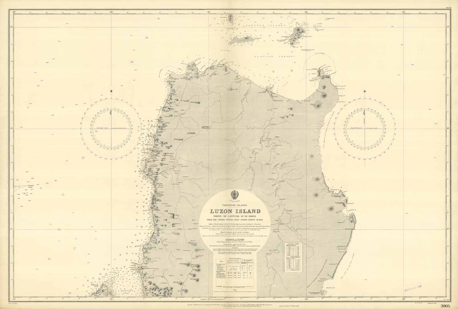
Carta nautica delle Filippine raffigurante la parte settentrionale dell'isola di Luzon tratta dalle carte dei rilievi costieri degli Stati Uniti del 1929. Piega editoriale. Il dominio statunitense ebbe inizio nel 1898 quando, in seguito alla vittoria nella Guerra ispano-americana, la Spagna si vide costretta a cedere Filippine, Cuba, Porto Rico e Guam agli Stati Uniti. During this period, the Philippines was under the colonial rule of the United States of America. American rule began in 1898 when, following its victory in the Spanish-American War, Spain was forced to cede the Philippines, Cuba, Puerto Rico, and Guam to the United States.
