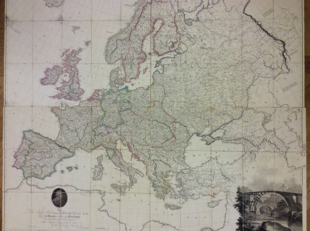
MAP OF EUROPE. - Drawn from all the best surveys and rectified by astronomical observations.
MAP OF EUROPE. - Drawn from all the best surveys and rectified by astronomical observations. | Prints | ARROWSMITH Aaron
MAP OF EUROPE. - Drawn from all the best surveys and rectified by astronomical observations.
MAP OF EUROPE. - Drawn from all the best surveys and rectified by astronomical observations. | Prints | ARROWSMITH Aaron
Payment methods
- PayPal
- Credit card
- Bank transfer
- Pubblica amministrazione
- Carta del Docente
Details
- Year of publication
- 1798
- Place of printing
- London,
- Publisher
- A. Arrowsmith,
- Engravers
- ARROWSMITH Aaron
- Keyword
- ARTE GRAFICA, EUROPA STAMPA ANTICA 1700
Description
Grande carta geografica dell'Europa, inc. in rame e a colori. E' composta di 4 fogli, montati su tela, ciascuno di cm. 64,5 x 73,7, suddivisi in 15 riquadri: vi figurano anche un ritratto del dedicatario, Sir Joseph Banks (President of the Royal Society), e una bellissima veduta che inquadra il titolo. Cfr. Tooley's Dictionary of Mapmakers, p. 24: Aaron Arrowsmith (1750-1833), English cartographer, engraver and publisher. Hydrographer to his Majesty. Established in London ca. 1770 and in 1790 set up his own establishment. In all he issued 200 maps, mostly large scale, and was easily the foremost cartographer of his time. Con aloni alla tela di due fogli, altrimenti ben conservata e contenuta in astuccio.
