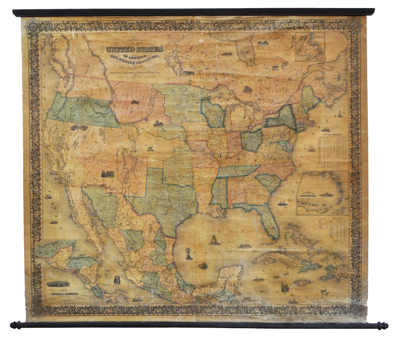
Map of the United States of America, the British Provinces, Mexico, and the West Indies, Showing the Country from the Atlantic to the Pacific Ocean
Map of the United States of America, the British Provinces, Mexico, and the West Indies, Showing the Country from the Atlantic to the Pacific Ocean | Prints | Colton Joseph Hutchins dis. & Mc. Lellan print., Colton Joseph Hutchins dis. & Mc. Lellan print.
Prints
Colton Joseph Hutchins dis. & Mc. Lellan print., Colton Joseph Hutchins dis. & Mc. Lellan print.
1854
2200.00 €
(Gavirate,
Italy)
Payment methods
- PayPal
- Credit card
- Bank transfer
- Pubblica amministrazione
- Carta del Docente
Details
- Year of publication
- 1854
- Size
- mm 1300x1460
- Edition
- 1854
- Engravers
- Colton Joseph Hutchins dis. & Mc. Lellan print.
- Keyword
- America settentrionale
- Designers
- Colton Joseph Hutchins dis. & Mc. Lellan print.
- Languages
- Italian
Description
Carta murale, in quattro fogli applicati su tela, raffigurante l'America Settentrionale. Di particolare interesse i cambiamenti territoriali realtivi alla parte occidentale degli Stati Uniti. Si vedano i territori di: Oregon. Wisconsin, Minnesota, California, New Mexico, Utah, Washington, Kansas e Nebraska. Alcuni restauri ma complessivamente buon esemplare.
