Porto Grande
Porto Grande | Prints | Admiralty Charts
Prints
Admiralty Charts
Porto Grande
Porto Grande | Prints | Admiralty Charts
Prints
Admiralty Charts
250.00 €
(Gavirate,
Italy)
Payment methods
- PayPal
- Credit card
- Bank transfer
- Pubblica amministrazione
- Carta del Docente
Details
- Size
- mm 476x600
- Edition
- '900
- Keyword
- Capo Verde Island
- Designers
- Admiralty Charts
Description
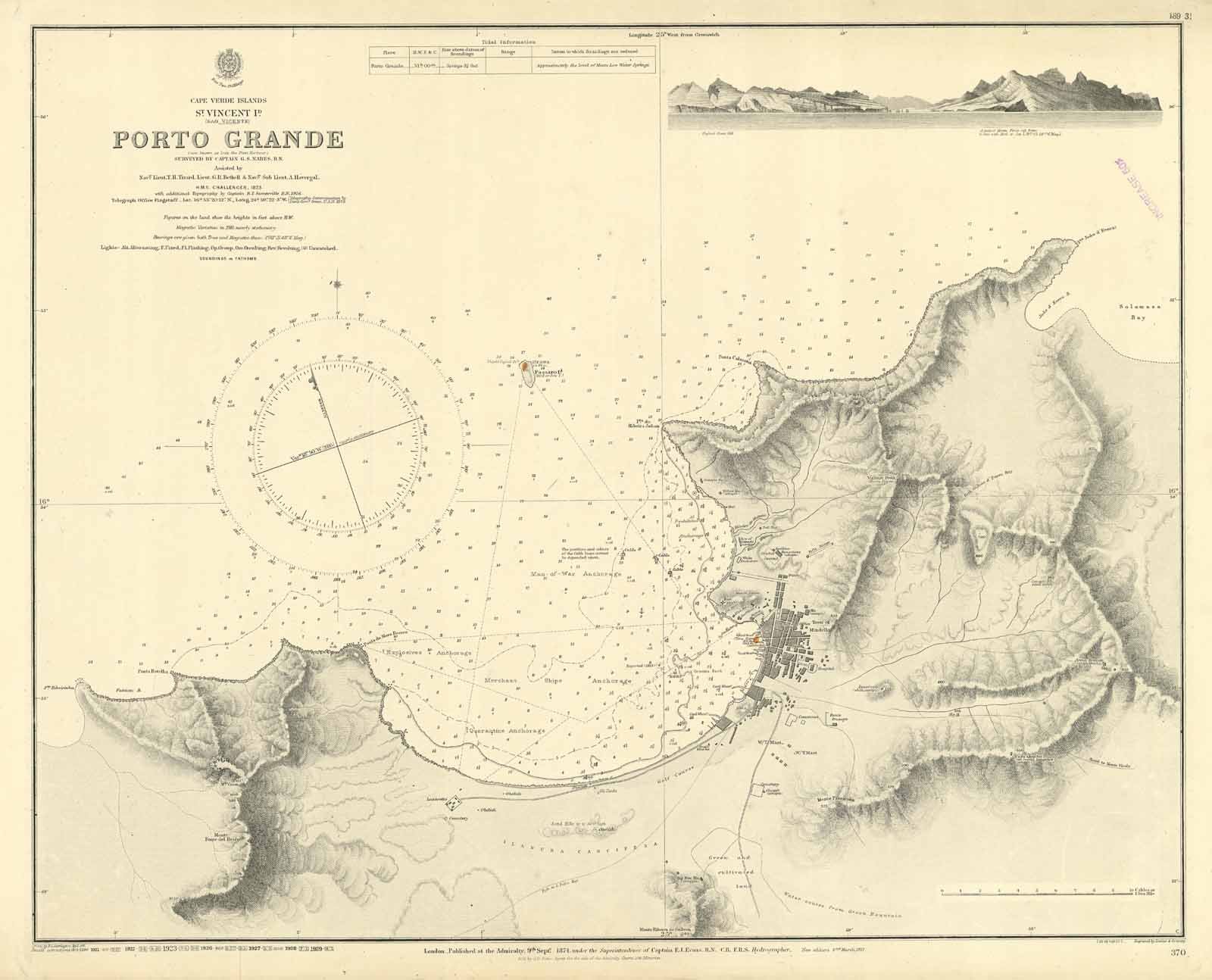
Porto Grande surveyed by Captain G.S. Nares, R.N. Assisted by Nav. Lieut. T.H. Tizard, Lieut. G.R. Bethell & Nav. Sub Lieut. A. Havergal, H.M.S. challenger, 1873. with additional Topography by Captain B.T. Somerville, 1916. London Published at the Admiralty 9th Sept. 1874 under the Superintendence of Captain F.J. Evans, Hydrographer. Small corrections: 1929. Autore: Admiralty Charts. Luogo: Capo Verde Island. Anno: '900. Dimensioni: 476x600 mm
Anno di pubblicazione: '900
