CARTE DES BORDS DU RHIN depuis Schaffhouse à Rotterdam avec Indication des Chemins de Fer. Se trouve à Basle chez Maehly-Lamy & chez Schreiber & Walz, à Londres chez Johanning & Co.
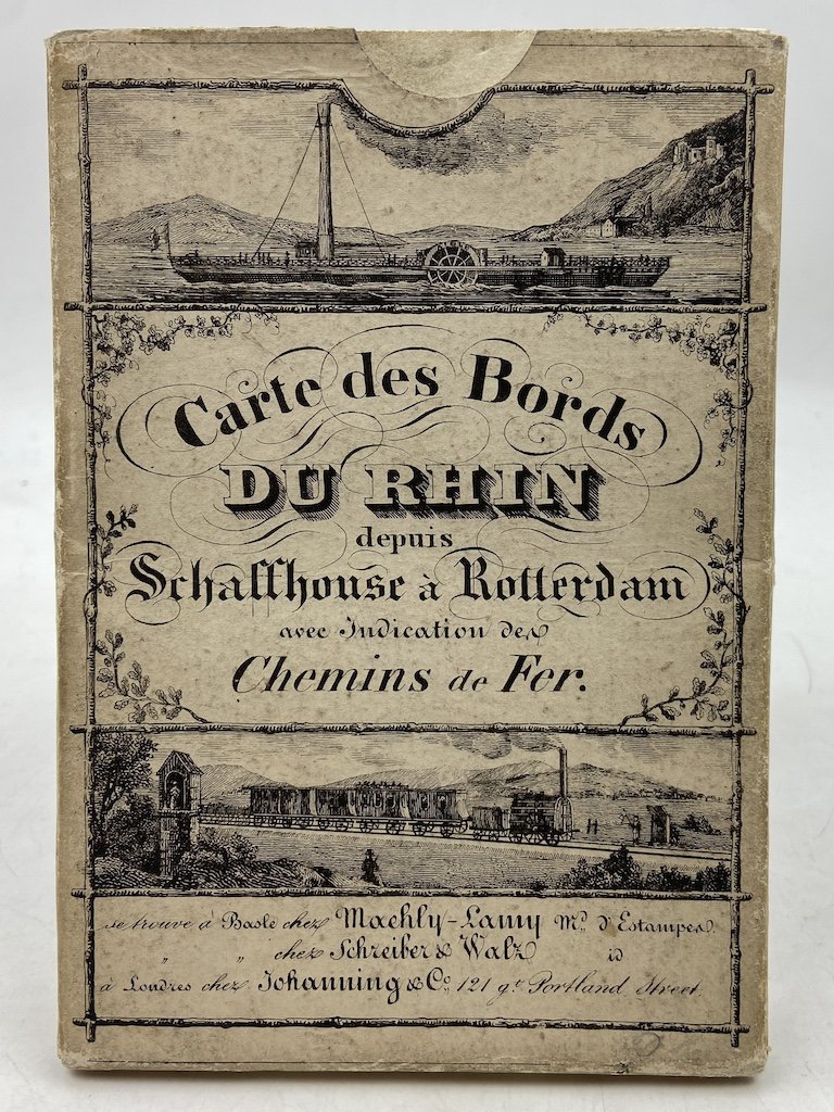
CARTE DES BORDS DU RHIN depuis Schaffhouse à Rotterdam avec Indication des Chemins de Fer. Se trouve à Basle chez Maehly-Lamy & chez Schreiber & Walz, à Londres chez Johanning & Co.
Payment methods
- PayPal
- Credit card
- Bank transfer
- Pubblica amministrazione
- Carta del Docente
Details
- Year of publication
- 1850
- Place of printing
- Basel
- Author
- Maurer
- Publishers
- Lith. P. Christen
- Keyword
- carte geografiche, panorami, reno, svizzera, Germania, olanda
- Binding description
- Buono stato di conservazione, un trascurabile taglietto lungo una piega.
Description
Carta geografica cm 128x29 ripiegata entro custodia illustrata (cm 10.5x16.5); la carta raffigura il corso del Reno da Sciaffusa a Rotterdam con riquadri dedicati a: «Chemins de Fer depuis Basle à Strasbourg», «Chemins de Fer de Strasbourg à Francfort», «Chemins de Fer de Cologne à Anvers etc» e «Cours des paqueboots [sic] et bateaux à vapeur en rapport avec les Chemins de Fer». Attorno alla carta 40 piccole vedute più 4 di medie dimensioni e 2 più grandi (Basilea e Rotterdam) in testa e alla base. Buono stato di conservazione, un trascurabile taglietto lungo una piega. A small cut along one of the folds, otherwise very well preserved in its original case; international shipping will require an export permit, usually taking a few weeks to be issued.