Rare and modern books
Collectif
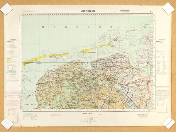
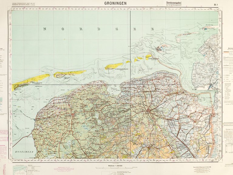
Groningen. Bl. 1 Chromo-Typografische Kaart van het Koninkrijk der Nederelanden 1 : 200.000 Sonderausgabe ! Nur für Dienstgebrauch ! [ German military map - Nederlands Groningen and Nordsee]
1940
250.00 €
Du Cardinal Librairie
(GRADIGNAN, France)
The correct shipping costs are calculated once the shipping address is entered during order creation. One or more delivery methods are available at the Seller's own discretion: Standard, Express, Economy, In-store pick-up.
Bookshop shipping conditions:
For items priced over €300, it is possible to request an instalment plan from Maremagnum. Payment can be made with Carta del Docente, Carta della cultura giovani e del merito, Public Administration.
Delivery time is estimated according to the shipping time of the bookshop and the courier. In case of customs detention, delivery delays may occur. Any customs duties are charged to the recipient.
For more infoPayment methods
- PayPal
- Credit card
- Bank transfer
-

-
 Find out how to use
your Carta del Docente -
 Find out how to use
your Carta della cultura giovani e del merito