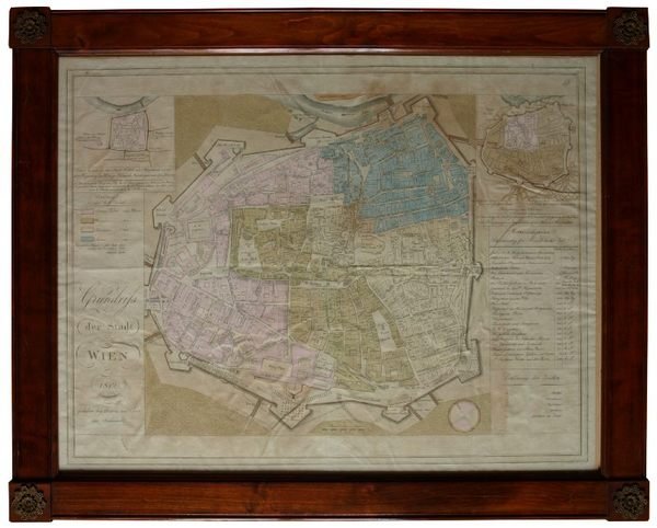
Grundriss der Stadt Wien 1812.
Rare and modern books
Mansfeld, Johann.
Vienna, Artaria, 1812.,
1812
Grundriss der Stadt Wien 1812.
Rare and modern books
Mansfeld, Johann.
Vienna, Artaria, 1812.,
1812
2500.00 €
(Wien,
Austria)
Payment methods
- PayPal
- Credit card
- Bank transfer
- Pubblica amministrazione
- Carta del Docente
Details
- Year of publication
- 1812
- Author
- Mansfeld, Johann.
- Publishers
- Vienna, Artaria, 1812.
- Keyword
- Maps, Views, Austriaca
- Languages
- English
Description
630 x 780 mm. Engraved map in original colour. Original Biedermeier frame with four brass corner fittings. This city map showing 1317 houses with their respective numbers was first published in 1802 as "Historischer Grundriss der Stadt Wien". It also shows two small historical plans (during the second Turkish siege in 1683 and in the 12th century). - Formerly owned by Katharina Schratt, companion and confidante of Emperor Franz Joseph, and removed from the so-called Schratt Villa in Hietzing's Gloriettegasse (see written statement by the heirs of the map's last owner, the collector Josef Ringer, 1916-2008). - Eckl collection IV, 755. Not in the Mayer collection.