Rare and modern books
Ordnance Survey
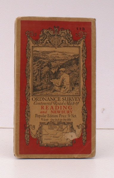
Ordnance Survey Contoured Road Map of Reading and Newbury. Popular Edition. Sheet 113 Scale: One Inch to One Mile. BRIGHT, CLEAN COPY
Ordnance Survey, Southampton, 1933
16.10 €
Island Books
(Devon, United Kingdom)
The correct shipping costs are calculated once the shipping address is entered during order creation. One or more delivery methods are available at the Seller's own discretion: Standard, Express, Economy, In-store pick-up.
Bookshop shipping conditions:
For items priced over €300, it is possible to request an instalment plan from Maremagnum. Payment can be made with Carta del Docente, Carta della cultura giovani e del merito, Public Administration.
Delivery time is estimated according to the shipping time of the bookshop and the courier. In case of customs detention, delivery delays may occur. Any customs duties are charged to the recipient.
For more infoPayment methods
- PayPal
- Credit card
- Bank transfer
-

-
 Find out how to use
your Carta del Docente -
 Find out how to use
your Carta della cultura giovani e del merito