PLANS ET CARTES GEOGRAPHIQUES POUR SERVIR A L'HISTOIRE DES CROISADES.
Rare and modern books
Michaud M.
Frères Reycend et C. Librares du Roi,,
1830

PLANS ET CARTES GEOGRAPHIQUES POUR SERVIR A L'HISTOIRE DES CROISADES.
Rare and modern books
Michaud M.
Frères Reycend et C. Librares du Roi,,
1830
51.00 €
(Rivalba,
Italy)
Payment methods
- PayPal
- Credit card
- Bank transfer
- Pubblica amministrazione
- Carta del Docente
Details
- Year of publication
- 1830
- Place of printing
- Turin
- Author
- Michaud M.
- Publishers
- Frères Reycend et C. Librares du Roi,
- Keyword
- CARTE GEOGRAFICHE, CROCIATE, STORIA MEDIEVALE MEDIOEVO
Description
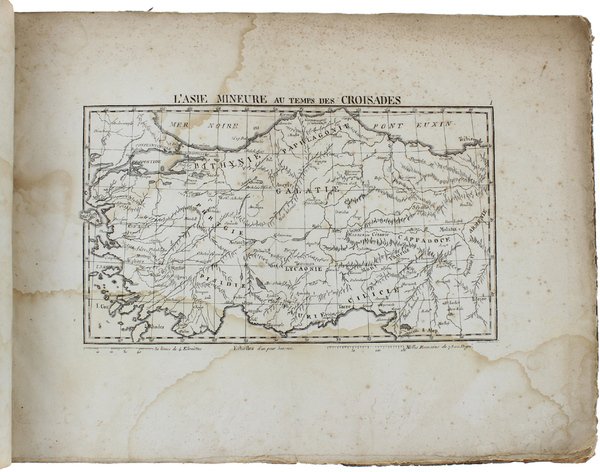
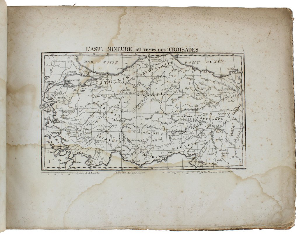
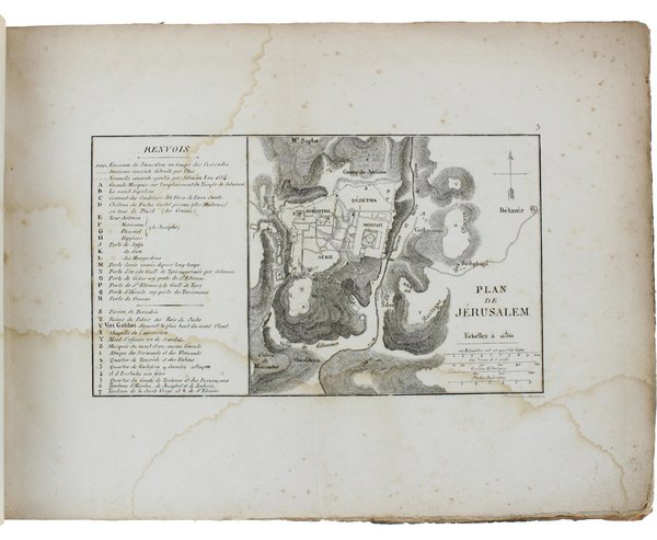
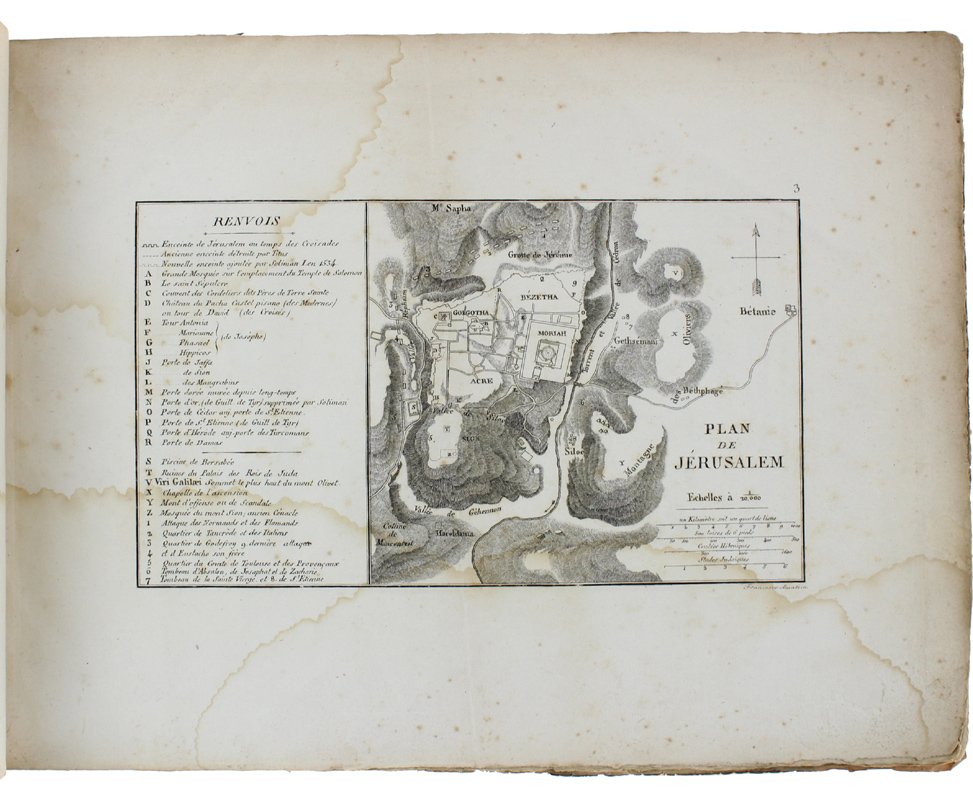
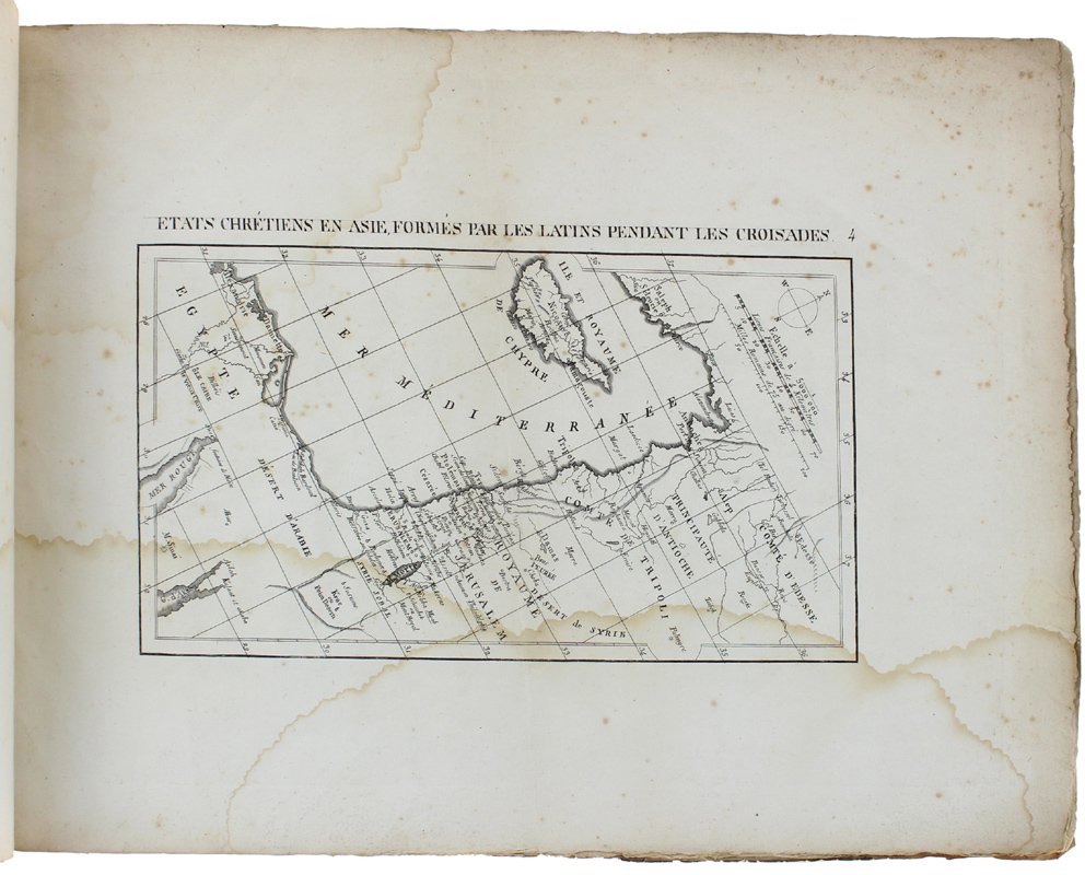
(Codice SB/0943) In 8º formato album (26.5x36 cm): 7 tavole finemente incise in rame da Francesco Amati, testi. Fa parte della 1a parte dell'opera "Histoire des Croisades" relativa alla prima crociata. Ingialliture, aloni. Grandi margini e barbe. Brossura editoriale usata, internamente riparata, strappetti marginali. ~~~ SPEDIZIONE IN ITALIA SEMPRE TRACCIATA