Red Sea - Gulf of Suez. Gimsah and Kabreit Anchorages and Approaches surveyed by Commander E. C. Hardy, R. N.
Rare and modern books
[Gulf Of Suez] - British Admiralty.
London, published at the Admiralty, 1920.,
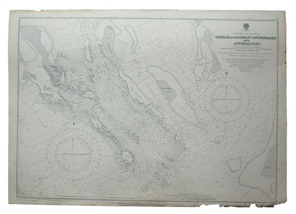
Red Sea - Gulf of Suez. Gimsah and Kabreit Anchorages and Approaches surveyed by Commander E. C. Hardy, R. N.
Rare and modern books
[Gulf Of Suez] - British Admiralty.
London, published at the Admiralty, 1920.,
800.00 €
(Wien,
Austria)
Payment methods
- PayPal
- Credit card
- Bank transfer
- Pubblica amministrazione
- Carta del Docente
Details
- Author
- [Gulf Of Suez] - British Admiralty.
- Publishers
- London, published at the Admiralty, 1920.
- Keyword
- Middle East, incl. Arabian Gulf: History, Travels, Falconry and Horses
- Languages
- English
Description
685 x 510 mm. Scale 1:29,100. Nautical chart (3752) of the Gulf of Suez. Engraved chart, including tidal information, compass roses, soundings, seabed notations, currents, sandbanks, shoals, inland elevations. This edition first published in 1909, revised in 1920, with stamp "examined & corrected 1926". Signs of contemporary use with markings in red ink. A few edge flaws.