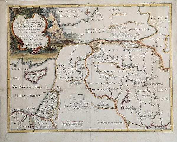
Afbeelding van alle de Landen gelegen tusschen de Middelandische…
Prints
BACHIENE William Albert
1750

Afbeelding van alle de Landen gelegen tusschen de Middelandische…
Prints
BACHIENE William Albert
1750
180.00 €
(Roma,
Italy)
Payment methods
- PayPal
- Credit card
- Bank transfer
- Pubblica amministrazione
- Carta del Docente
Details
- Year of publication
- 1750
- Place of printing
- Gorinchem
- Size
- 515 X 405
- Engravers
- BACHIENE William Albert
Description
Affascinante mappa che mostra la terra di Israele con tutti i luoghi, fiumi, montagne e mari menzionati nelle Sacre Scritture.Incisione in rame, bella coloritura, in ottimo stato di conservazione.Inciso da Jan van Jagen e pubblicato in un'edizione olandese della Bibbia da Nicolas Goetzee. This attractive map from a large Dutch Bible shows the land of Israel with all the places, rivers, mountains, and seas mentioned in the Holy Scriptures.Copperplate with fine later hand colour, very good condition.Engraved by Jan van Jagen and published in a Dutch Bible by Nicolas Goetzee. Cfr.