Antarctica Compiled and Drawn in the Cartographic Division of the National Geographic Society. September 1957
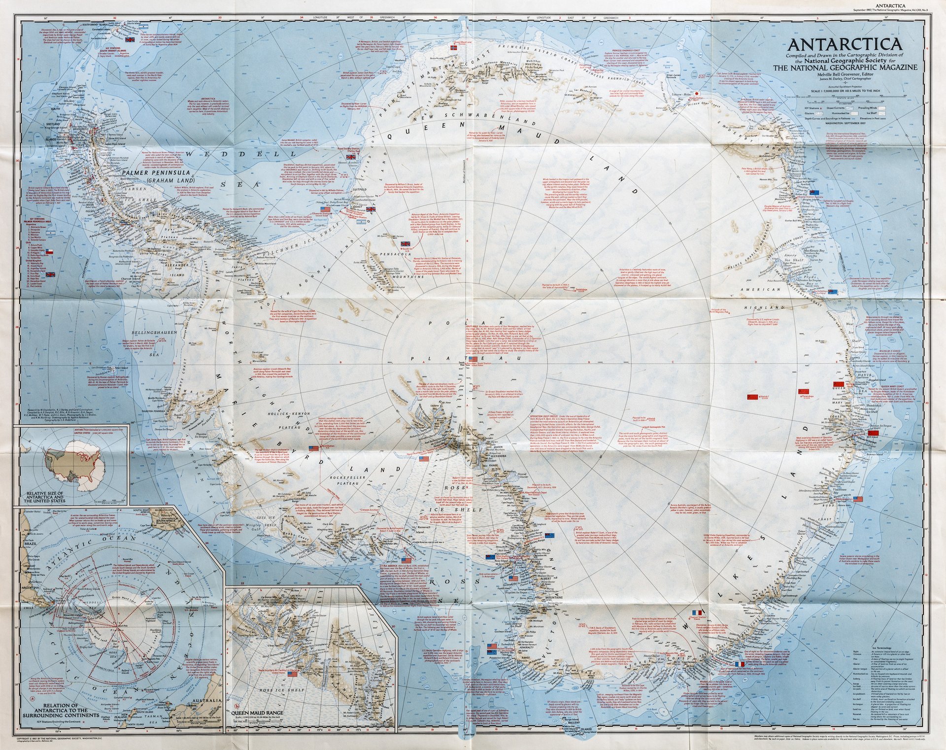
Antarctica Compiled and Drawn in the Cartographic Division of the National Geographic Society. September 1957
Payment methods
- PayPal
- Credit card
- Bank transfer
- Pubblica amministrazione
- Carta del Docente
Details
- Year of publication
- 1957
- Place of printing
- Washington
- Engravers
- THE NATIONAL GEOGRAPHIC SOCIETY
- Keyword
- Antartide
Description
Mappa dell’Antartide preparata per celebrare due recenti spedizioni americane, l’Operazione Deep Freeze dell’ammiraglio George Dufek, che raggiunse il Polo Sud il 31 ottobre 1956 e la spedizione di Paul Siple (1856-1858), che conduesse esperimenti con un soggiorno di 18 mesi al Polo Sud. La mappa fornisce un’ottima panoramica dell’estensione indicando con bandiere le stazioni mantenute da diverse nazioni. Include molte note storiche riguardanti la scoperta e l’esplorazione del continente e mostra inoltre venti, correnti oceaniche, ghiacciai. Ottimo esemplare in perfetto stato di conservazione.<BR>Map of Antarctica prepared to celebrate two recent American expeditions, Admiral George Dufek’s Operation Deep Freeze, which reached the South Pole on October 31, 1956, and Paul Siple’s (1856-1858) expedition, which conducted experiments with a living room of 18 months at the South Pole. The map gives a very good overview of the extent by flagging stations maintained by different nations. It includes many historical notes regarding the discovery and exploration of the continent and also shows winds, ocean currents, glaciers.