Germaniae veteris typus
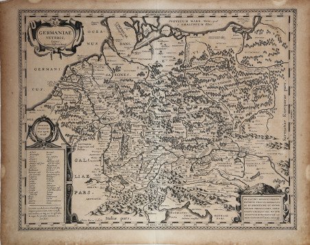
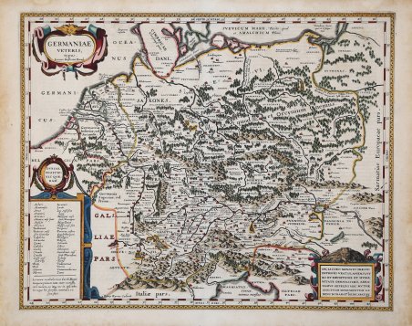
Germaniae veteris typus
Payment methods
- PayPal
- Credit card
- Bank transfer
- Pubblica amministrazione
- Carta del Docente
Details
- Year of publication
- 1618
- Place of printing
- Anversa
- Size
- 490 X 390
- Engravers
- JANSSONIUS Johannes
- Keyword
- Carte Storiche
- Languages
- Italian
Description
Splendida carta dell'antica Europa centrale pubblicata da Johannes Janssonius; una fedele copia della carta ideata da Abraham Ortelius e pubblicata nel Parergon Theatri. Intagliata in rame dal famoso incisore fiammingo Pieter van den Keere. In alto a sinistra un cartiglio con il titolo, in basso a sinistra un cartiglio con luoghi di incerta ubicazione. La carta, come la sua fonte, contiene la dedica di Ortelius a Iacobus Monavius. Mostra l'area che va dal Mare del Nord e dal Mar Baltico a nord fino al sud delle Alpi e al Mare Adriatico a sud. A ovest si trovano l'Olanda e la foce del Reno. A est si trova il fiume Weichsel. Le città dell'epoca di Carlo Magno (VIII-IX secolo) sono indicate nella legenda in basso a sinistra e segnate in modo particolare sulla carta. Prima edizione, dal Theatri Geographia Veteris di Petrus Bertius, Amsterdam 1618. Acquaforte, finemente colorata a mano, in ottimo stato di conservazione. Beautifully colored copper engraved map of ancient Central Europe after Abraham Ortelius by Johannes Janssonius. Engraved by the famous Flemish engraver Pieter van den Keere. To the upper left a title cartouche, the lower left cartouche with places of uncertain location. The map, as his source, is dedicated in the lower left cartouche to Iacobus Monavius by Abraham Ortelius. It shows the area from the North Sea and Baltic Sea in the north to south of the alps and the Adriatic Sea in the south. In the west is Holland and the mouth of the Rhine. In the east is the Weichsel river. The towns and cities from the time of Charles the Great (8-9 centuries) are in the legend in the lower left and especially marked on the map. First edition, from Theatri Geographia Veteris by Petrus Bertius, Amsterdam 1618. Copper engraving, fine later hand colour, in good condition. Cfr. cfr. M. Van den Broecke "Ortelius Atlas Maps" (2011), n. 200; Van der Krogt 1, 1:202.