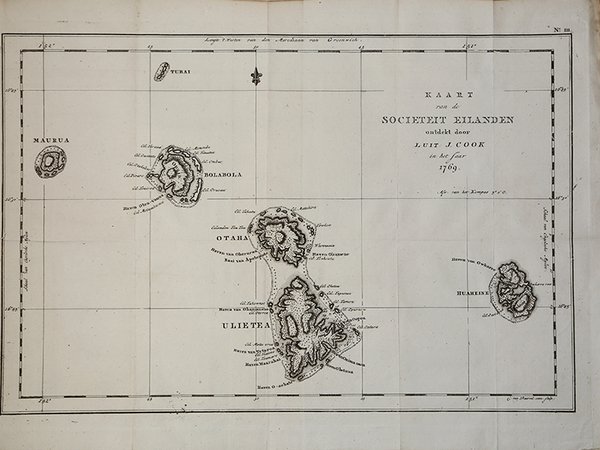
Kaart van de Societeit Eilanden ontdekt door Luit. J. Cook…
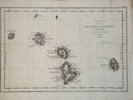
Kaart van de Societeit Eilanden ontdekt door Luit. J. Cook…
Payment methods
- PayPal
- Credit card
- Bank transfer
- Pubblica amministrazione
- Carta del Docente
Details
- Year of publication
- 1780
- Place of printing
- Parigi
- Size
- 435 X 230
- Engravers
- COOK James
- Keyword
- Pacifico e Oceania
Description
Carta geografica tratta dall'atlante della relazione di James Hawkesworth "Cartes et figures des voyages entrepris par ordre de sa Majesté Britannique pou fair des découvertes dans l'hémisphère méridional; exécutes par Byron, Carteret, Wallis & Cook dans les vaisseaux le Dauphin, Le Swallow & l'Endeavour" pubblicata in più edizioni di lingua francese, inglese, olandese ed italiano. Incisione in rame, in ottimo stato di conservazione. Captain James Cook (1728-79), explorer, circumnavigator and hydrographer. Three voyages, 1768-71, 1772-75 and 1776-79. From 1778 on printed editions of ' Captain Cook's Travels' appeared in English, Italian, French and Dutch. A map of the Society Islands. From a Dutch edition of "Cook's voyages". Copper engraving. Traces of the original folds. Perfect conditions. Cfr.