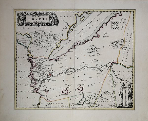
Nova Aegypti Tabula
Prints
BLAEU Johannes
1650
Nova Aegypti Tabula
Prints
BLAEU Johannes
1650
300.00 €
(Roma,
Italy)
Payment methods
- PayPal
- Credit card
- Bank transfer
- Pubblica amministrazione
- Carta del Docente
Details
- Year of publication
- 1650
- Place of printing
- Amsterdam
- Size
- 520 X 440
- Engravers
- BLAEU Johannes
Description
Bella e decorativa carta dell'Egitto e del Mar Rosso orientata con l'Est in alto. La carta, edita per la prima volta nel "Atlas Major" del Blaeu, viene succesivamente ristampata da Frederick de Wit, circa 1680. Incisione in rame, coloritura coeva, in ottime condizioni. Beautiful map of northern Egypt and the Red Sea. With an ornate cartouche and two surveyors supporting the mileage scale. Top right a coat of arms emblazoned with three vipers. The map is oriented with north to the left. Two groups of pyramids are shown. Later issue by Frederick de Wit, circa 1680. Copperplate, original colouring, fine conditions. Cfr.