Solomon Islands
Prints
Admiralty Charts, Admiralty Charts
Solomon Islands
Prints
Admiralty Charts, Admiralty Charts
200.00 €
(Gavirate,
Italy)
Payment methods
- PayPal
- Credit card
- Bank transfer
- Pubblica amministrazione
- Carta del Docente
Details
- Size
- mm 660x990
- Edition
- '900
- Engravers
- Admiralty Charts
- Keyword
- Salomon Islands - Pacific Ocean
- Designers
- Admiralty Charts
- Languages
- Italian
Description
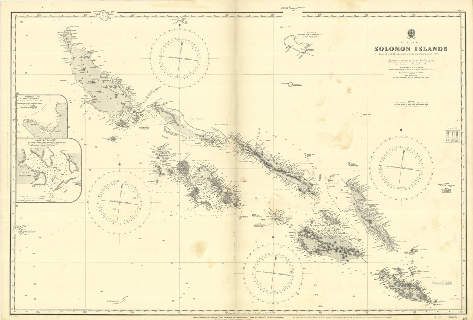
Solomon Islands From All available information in the Hydrographic Department to 1931. In the left side of the chart insert of Gazelle Harbour From the German Government Charts to 1919, Gizo Anchorage by Lieut F.J. Rendell & Nav. Sub. Lieut J.W. Brown 1875. London Published at the Admiralty 7th July 1874, under the Superintendence of Captain F.J. Evans, Hydrographer. Small corrections. Folded editorially. Autore: Admiralty Charts. Luogo: Salomon Islands - Pacific Ocean. Anno: '900. Tecnica: incisione. Dimensioni: 660x990 mm
Anno di pubblicazione: '900