Details
Engravers
SCHERER Henrick
Description
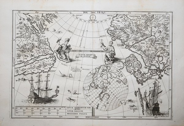
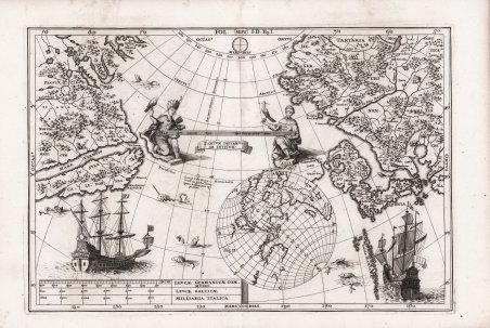
Interessante e rara carta dell'area dell'Oceano Pacifico con una parte dell'America occidentale e dell'Asia orientale. L'aspetto più peculiare della carta è la proiezione rovesciata, a "specchio", per cui il Giappone è a est e il Nord America a Ovest. La California è rappresentata come un'isola. Splendida mappa, decorata al centro da due figure maschili che rappresentano i due continenti, da due grandi velieri e mostri marini. Pubblicata nell'opera di Heinrich Scherer ' Atlas Novus exhibens orbem terraguem per naturae opera, historiae navae acveterus monumenta, artistique geographicae leges et praecepta ' edita in 8 parti, stampate tra il 1702 e il 1710 a Monaco di Baviera. Heinrich Scherer, professore di matematica a Monaco di Baviera, era un gesuita devoto la cui opera sottolineava la gerarchia cattolica e la diffusione delle missioni gesuite in tutto il mondo. Il suo ' Atlas Novus ' contiene mappe di tutte le altre parti che mostravano la diffusione del cattolicesimo e delle missioni gesuite. Le 180 mappe incluse in questo lavoro sono state preparate tra il 1699 e il 1700 e sono state incise da Leonard Hecknaeur, Joseph Montelegre e Matthus Wolfgang; ogni volume è introdotto da splendidi frontespizi allegorici dagli stessi incisori. Incisione su rame, in ottimo stato di conservazione. Interesting map of the Pacific Ocean North West of America and the North East of Asia by Heirich Scherer for his Atlas Novus exhibens orbem terraguem per naturae opera, historiae navae acveterus monumenta, artistique geographicae leges et praecepta.published in eight volumes from 1702-1710 in Munich. Scherer, a devout Jesuit, produced this geographical compendium to depict the Catholic hierarchy and the spread of Jesuit missions throughout the world.The map reflects the European knowledge of the Pacific North West of America and the North East of Asia in the early 18th century. The most striking aspect of the map is that it is projected as a mirror image of the actual surface geography with Japan in the east and North America in the West.Of particular interest with this rare map is the depiction of California. California was for the the better part of a century depicted as an island. However, this theory would be disproved following Father Eusebio Francisco Kino’s mission to Baja California in 1701. Although his findings would only be published 1705, cartographers such as Scherer and Nicolas De Fer began to contemplate Baja California as a peninsula. That being said, this map continues to perpetuate the California as an island myth.Two figures are shown on the map: the first is positioned on the left side of the title cartouche and depicts a Native American. The second figure, parallel to the figure on the left side, is dressed in Middle Eastern garments with a hawk perching on his outstretched hand.The map in also decorated with two ships and sea monsters.Copper engraving, in very good condition. Cfr.

 Find out how to use
 Find out how to use