The European Part of the Russian Empire, From Maps Published by the Imperial Academy… - The Asiatic Part of the Russian Em
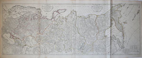
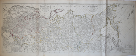
The European Part of the Russian Empire, From Maps Published by the Imperial Academy… - The Asiatic Part of the Russian Em
Payment methods
- PayPal
- Credit card
- Bank transfer
- Pubblica amministrazione
- Carta del Docente
Details
- Year of publication
- 1794
- Place of printing
- Londra
- Size
- 1294 X 494
- Engravers
- LAURIE & WHITTLE
Description
Mappa molto dettagliata dell'Impero russo alla fine del XVIII secolo, realizzata da William Faden.La mappa si estende dal Mare del Nord e dal Mar Nero fino alla Siberia e allo Stretto di Behring, e a sud verso la Cina e il Lago d'Aral, fino ad includer, a nord, l'isola di Novaja Zemlja e l'Artico.È indiscutibilmente una delle migliori e più dettagliate mappe di tutta la Russia imperiale ad apparire in un atlante commerciale alla fine del XVIII secolo.Mappa tratta dal "Kitchin's General Atlas, describing the Whole Universe" di Thomas Kitchin, una raccolta contenente alcune tra le mappe più accurate esistenti, realizzate con la massima precisione, e integrata dalla precedente edizione di D'Anville e Robert con i lavori di molti altri eminenti geografi. L'atlante, pubblicato Laurie & Whittle a Londra nel 1797, raccoglie 62 incisioni, che comprendono 37 mappe.Acquaforte, coloritura coeva dei contorni, in ottimo stato di conservazione. Highly detailed map of the Russian Empire at the end of the 18th Century, by William Faden.The map extends from the North Sea and the Black Sea eastward as far as Siberia and the Behring Strait. The map reaches south to China and the Aral Sea and north to include the island of Nova Zembla and the Arctic. It is without question one of the best and most detailed maps of the whole of Imperial Russia to appear in a Commercial atlas in the late 18th Century.Map taken from "Kitchin's General Atlas, describing the Whole Universe" by Thomas Kitchin: being a complete collection of the most approved maps extant; corrected with the greatest care, and augmented from the last edition of D'Anville and Robert with many improvements by other eminent geographers, engraved on Sixty-Two plates, comprising Thirty Seven maps., Laurie & Whittle, London, 1797.Etching with original outline colour, very good condition. Cfr.