Details
Place of printing
Augsburg
Engravers
SEUTTER "il vecchio" Matthaus
Keyword
Piante e Panorami di Roma
Inscription description
Huelsen (1915): n. 121; Marigliani, Le Piante di Roma nelle Collezioni private, pag. 235, 140.
Description
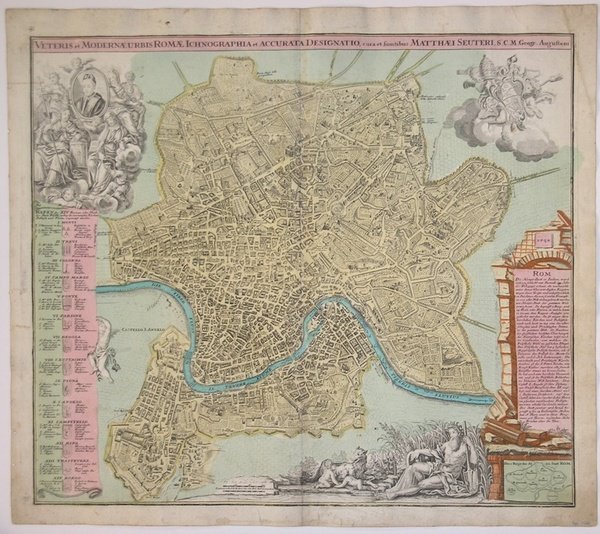
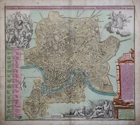
Pianta della città edita da Mattheus Seutter, inclusa nel suo "Atlas" del 1730. La pianta deriva da quella di Giovan Battista Falda del 1676, della quale è una fedele ed accurata riduzione. In alto a sinistra compare il ritratto del papa Benedetto XIII (1724-30) e a destra il suo stemma. In basso a sinistra un elenco del XIV rioni ed a destra una breve descrizione della città dal titolo di Rom. Sebbene stampata intorno al 1725, probabilmente in occasione del Giubileo visto l'inserimento delle Sette Basiliche, raffigura la città intorno al 1676. L'opera infatti non contempla le innovazioni architettoniche alla città durante il pontificato di Innocenzo XII e nemmeno il Porto di Ripetta del 1704. Matthäus Seutter (1678 - 1757) fu uno dei più importanti e prolifici editori tedeschi di mappe del XVIII secolo. Attivo, come incisore sotto la tutela dell'importante J. B. Homann. All'inizio del 1700 Seutter lasciò Homann per tornare ad Augusta, dove lavorò per l'importante editore d'arte Jeremia Wolff (1663 - 1724), per il quale incise mappe e altre stampe. Intorno al 1717 fondò la propria casa editrice cartografica indipendente ad Augusta. La maggior parte delle mappe di Seutter sono pesantemente basate, se non addirittura copie, di lavori precedenti fatti dalle calcografie Homann e De L'Isle. Ciononostante, dal 1731/32 Seutter era uno degli editori più prolifici del suo tempo e fu onorato dall'imperatore tedesco Carlo VI che gli diede il titolo di Geografo Imperiale, dopo il quale la maggior parte delle mappe successive includeva la denominazione ' Avec Privilege. ' Seutter continuò a pubblicare fino alla sua morte, all'apice della sua carriera, nel 1757. Incisione in rame, tipica coloritura a mano editoriale, in ottimo stato di conservazione. Map of the city edited by Mattheus Seutter, included in his "Atlas" of 1730. The map derives from that of Giovan Battista Falda of 1676, of which it is a faithful and accurate reduction. On the upper left is the portrait of Pope Benedetto XIII (1724-30) and on the right his coat of arms. In the lower left a list of the XIV districts and on the right a brief description of the city entitled Rom. Although printed around 1725, probably on the occasion of the Jubilee given the inclusion of the Seven Basilicas, it depicts the city around 1676. The work in fact does not contemplate the architectural innovations to the city during the pontificate of Innocenzo XII, nor the Port of Ripetta of 1704. Mattha?us Seutter (1678 - 1757) was one of the most important and prolific German map publishers of the 18th century. Seutter was born the son of a goldsmith but apprenticed as a brewer. Apparently uninspired by the beer business, Seutter abandoned his apprenticeship and moved to Nuremberg where he apprenticed as an engraver under the tutelage of the prominent J. B. Homann. Sometime in the early 1700s Seutter left Homann to return to Augsburg, where he worked for the prominent art publisher jeremiad Wolff (1663 - 1724), for whom he engraved maps and other prints. Most of Seutter's maps are heavily based upon, if not copies of, earlier work done by the Homann and De L'Isle firms. Nonetheless, by 1731/32 Seutter was one of the most prolific publishers of his time and was honored by the German Emperor Karl VI who gave him the title of Imperial Geographer, after which most subsequent maps included the Avec Privilege designation. Copper engraving, typical editorial hand coloring, in excellent condition. Cfr. Huelsen (1915): n. 121; Marigliani, Le Piante di Roma nelle Collezioni private, pag. 235, 140.

 Find out how to use
 Find out how to use